I finally got called for SDIS (Satellite Digital Imaging System) mission assignment to Baton Rouge late last Sunday night the 4th. Flew out of Rogers on Labor Day. We flew our Rogers CAP cessna 182R to Little Rock, pick up another pilot there and flew to Baton Rouge. The crew we were relieving returned in our aircraft and we used N8336CP which is equipped with the SDIS system and has a photo window.

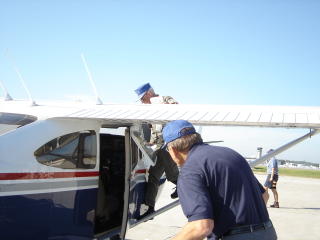
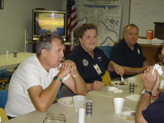
My crew, Max & Robert, preflighting the aircraft before liftoff Thursday moring. Baton Rouge airport has been the busiest airport in the US all this week while we have been there - with a whole lot of the rescue helicopters being based there- with TFR's in place while Bush was there Monday shortly before our arrival. We were out on a sortie when Cheney came in Thursday. I just barely got to see Tim McGraw when he came by the CAP building on Thursday to thank us for all our efforts.

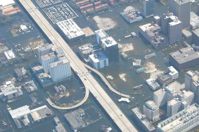
This photo showing the superdome was taken with my little sony cybershot through the window of the aircraft from about 3500 ft. because we were moving too fast for me to open the photo window. It turned out pretty good.
Our assigned sorties were all photography. Each morning bettween 7 & 8 we would get an assigned sortie with a list of GPS coordinates and a short description of our targets and sometimes we would get a satellite photo to help us locate the target. We would lift off as soon as we plotted our course and were brieffed. I was terrified after the 1st day's morning initial briefing when they told us there was no separation (radar calls to warn about other traffic in one's vacinity) available in the area over New Orleans. New Orleans approach was not working and the communications aircraft (an AWACS above)monitoring the TFR (traffic flight restrictions)did not provide that service. We were on our own watching out for traffic. There were hundreds of helicopters in the area at or below 500 feet, C-130's at our altitude of 3000 to 3500 ft. and various other eagle flights, etc. I had of course never seen a presence like this in any of my training and was thinking how will I ever make it through this 4 day deployment????. It turned out just fine though because after about 10 minutes in the target area I was too busy to be scared and the other aircraft in the area were being just as careful as we were so we really were not in danger.
The first sortie was frought with on the job training opportunities. Of course this particular SDIS setup I had not trained on so I had to wing it setting up the system in the aircraft. The Globalstar Satallite System that our systems hits on was totally choked up. Band widths were flooded with all the satelite phones that had been handed out in New Orleans so nobody was getting through. So much for the instantaneous access to our photos.
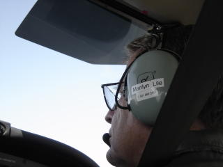
We flew right into the heart of the devestation but really had no time to look at anything because we were constantly watching for air traffic. We would locate our target using the GPS coordinates- process too involved to put here- from 3500 ft. - then decend to 1000 ft go into slow flight, open the photo window, stick the camer out the aircraft, focus in and out, get bumped off of focus, refocus.....etc, take photos - then return to 3500 to locate next target. Between targets, I was uploading target pics to the tablet computer onboard, looking for traffic, and generally bouncing around left to right in the two back seats. We flew a 5 to 6 hour sortie each day, returned to base, then spent several hours sorting photos and uploading them to the internet, showers, to bed, and up at 5 the next morning to start over again.
Our team targets included numerous nursing homes, universities, LTC's Louisiana Technical schools, bridges, an airport, and levee damage. We had to request another hour of flight time several times and got tasked to do an equipment transport from anothe airport once. Other CAP aircrafts like the G8 airvan that could hold more passengers got tasked to transport evacuees and others. More later..........

I returned from Baton Rouge Friday around 4.


